-
-
Selecting Fields from the Farmobile DataEngine account will open the Fields page with all of your farms and fields listed and displayed on the map.
-
-
-
Select a field to open the field details page.
-
Click on a field within your field list.
-
Or, select a boundary on the map to open the pop-up. Then select the pop-up.
-
The field details page will open with the selected field highlighted orange.
-
-
-
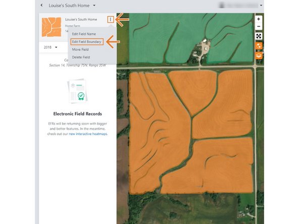
Select the ellipse button next to the field name.
-
In the menu, select 'Edit Field Boundary'.
-
This will open the Edit Field Boundary window.
-
-
-
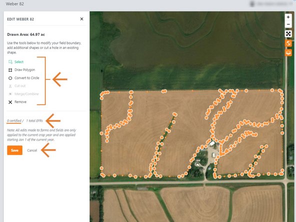
Use the edit tools to edit the boundary.
-
Boundaries are not allowed to overlap other boundaries.
-
Draw an additional boundary and have multiple selected to enable the cut out and merge/combine tools enabled.
-
Select 'Save' to save the new boundary.
-
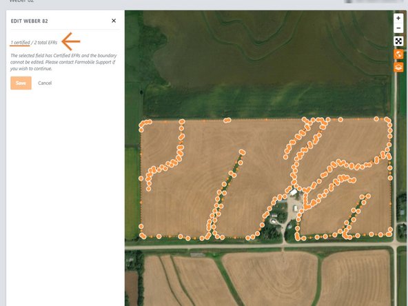
NOTE: If the field has a certified Electronic Field Record (EFR) you are not allowed to edit the boundary.
-
We prevent this edit to keep your certified data available for the Farmobile DataStore℠ exchange.
-
Select 'Cancel' to close the window.
-
Contact Farmobile Support if you wish to edit the boundary.
-