How to Draw Field Boundaries
Already have field boundaries? Email them directly to the support team and we will uploaded the boundaries directly into your account.
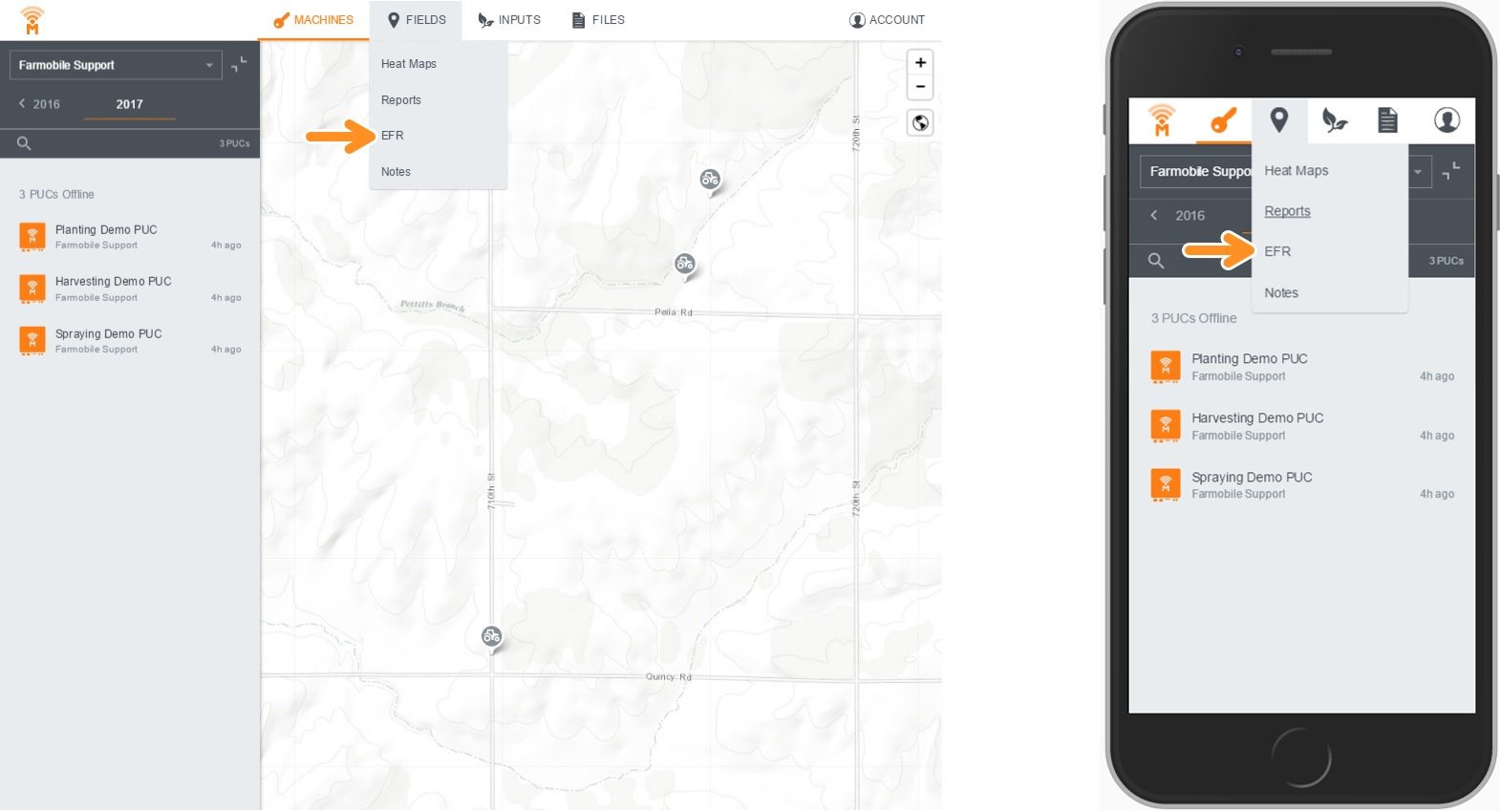
Step 1:
- Navigate to EFR under the Fields tab.
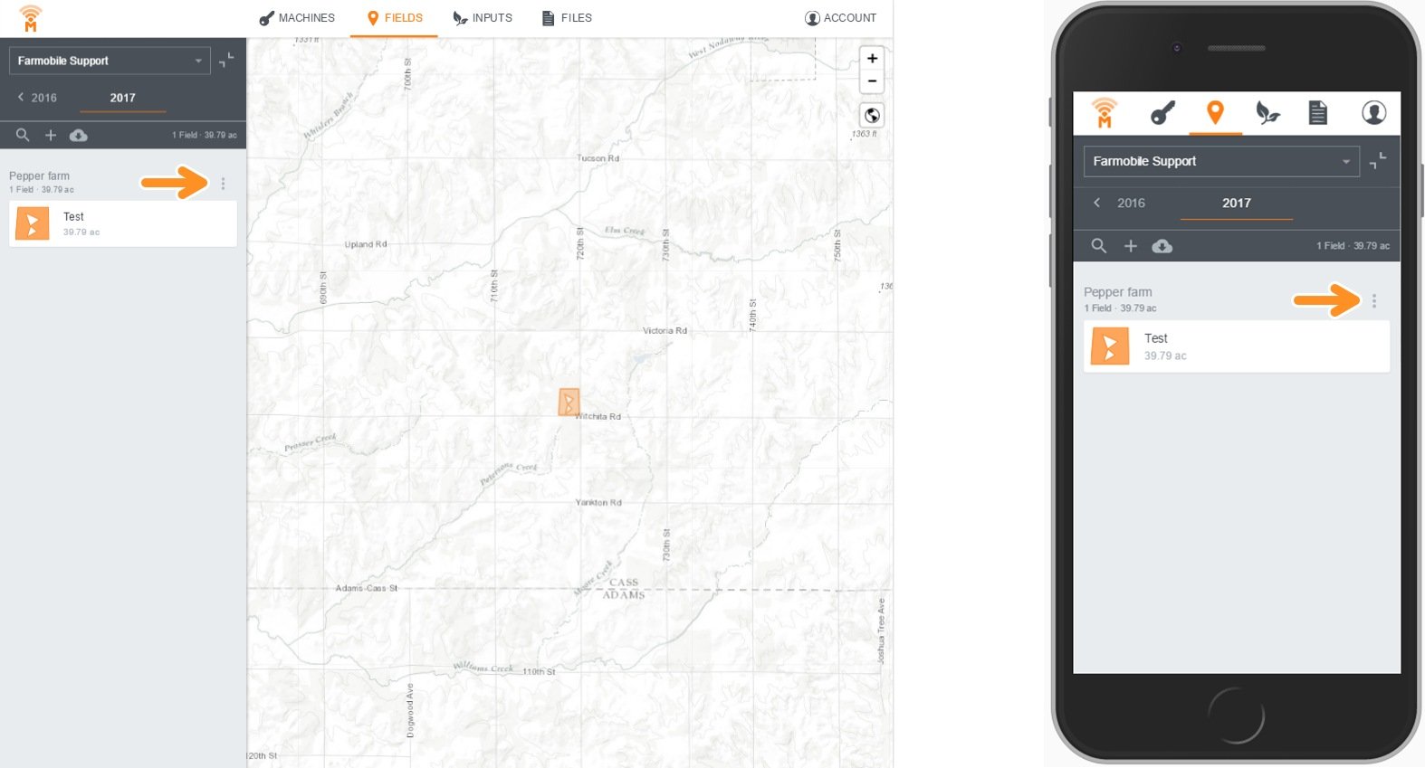
Step 2:
- Select the three vertical dots on the right side of the page.
- Note: If you have existing field boundaries, they will show as a list. If you'd like to upload your boundaries, contact Farmobile Support.
Step 3:
- Select Add New Field.

Step 4:
- Toggle between road and satellite maps to see field outline.
- Begin drawing boundaries by clicking/tapping on map.
- Continue drawing by clicking/tapping along outline.
- Once you have finished drawing, click on the starting point (circle) to complete the field.
- Note: On mobile, use the arrows to minimize the instructions page.
- Tip: Use the map view toggle to better locate your field.
- Tip: Use the zoom in and out feature to accurately draw the field.

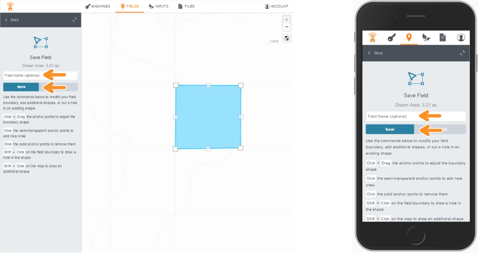
Step 5:
- Type your field name.
- Save your changes.