-
-
Selecting Fields from the Farmobile DataEngine platform menu will open the Fields page with all of your Farms and Fields listed and displayed on the map.
-
-
-
Select a field to open the field details page.
-
Click on a field within your field list.
-
Or, select a boundary on the map to open the pop-up. Then select the pop-up.
-
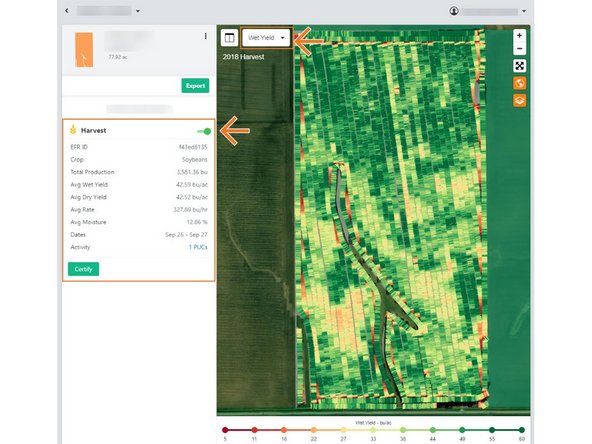
The field details page will open with the most recent EFR heatmap loaded.
-
-
-
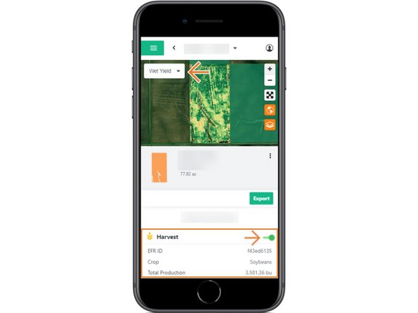
EFR's are listed in reverse chronological order, with the most recent agronomic activity for the selected field listed at the top.
-
The most recent EFR will by default have the heatmap toggled on to view on the map.
-
Review the key agronomic values for each EFR.
-
Toggle on each EFR to view on the map.
-
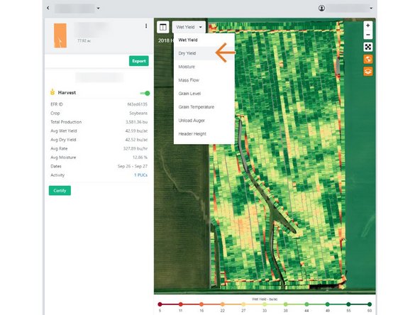
Select the drop down menu in the top-left corner of the map to display another agronomic attribute on the map.
-
Note: If agronomic data is unavailable for the selected attribute, a grey machine path will be displayed.
-